Buy 3, Get 1 FREE Hard Baits Through 05/07. Learn More

Buy 2, Get 1 FREE Soft Baits Through 04/30. Shop Now

25% Off Bass Mafia Tackle Storage, Through 05/07. Shop Now

Free Rapala Touch Screen Scale w/ Omnia PRO Signup. Learn More

35% Off Omnia Apparel, Through 05/07. Shop Now

$3 Mystery Overstock Lure Valued up to $10. Shop Now

Markdowns on popular products - See all bargain offers

Omnia Fishing
  • Search Site
Omnia Fishing

Omnia PRO: C-Map Social Layers with Matt Johnson and Polish Pete

Published: Updated:

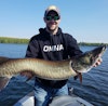
Omnia CEO Matt Johnson breaks down how C-Map works in Omnia PRO with Polish Pete.

  • Pete Przepiora

    Jump to 0:00

  • Matt Johnson

    Jump to 0:00

  • Omnia Fishing

    Omnia Fishing

    Jump to 0:23

    Start your PRO trial now! https://www.omniafishing.com/pro

All Featured Products

    Video Transcript

    We're back with more features in Omnia Pro. We're offering this on web and on Android and Apple devices. You can go sign up for a pro membership right now and you get access to all the layers that we're talking about. Lately we've been talking a lot about temperature and water clarity, but we've moved on to social mapping. These layers have been around a little bit longer than the other ones. This is information we get from our friends at Lowrance. This is C-Map to be exact. This is social mapping that is available to you pro members to aid you in conjunction with our mass coverage and contours with Navionics or our temperature layers or water clarity layers. These are little nuggets of information that we get from the social mapping aspect, which this guy over here knows a lot about and he could tell you where we get this information that you get from the C-Map social maps. First things I want to talk about the three layers that do come from our partners at Lowrance C-Map. Contour lines, bottom hardness and vegetation. Three key map layers for your toolkit. Now most importantly, these are not full coverage maps. Where it comes from is actually Lowrance customers are submitting their sonar log files. They're uploading it to the C-Map platform and they're processing it and combining all this. What ends up happening is because of the amount of data that's coming in on those chips, the information's really accurate. So if you're digitizing old DNR maps, you're not gonna get really great results. They're great reference maps. But if you're not continuously adding to and continuing to improve those maps, you're not getting a full view of the contours. You've seen lots of lakes in Minnesota, specifically where it says that the hump looks like this and it actually looks like this. That's gonna get picked up on these depth contours. So it's a great supplement to our Navionics layer, which we currently have available or a full C-Map subscription that you can get from Lowrance. The other big one is vegetation. So we know that in the sonar signal, we can see that top of plant and sonars change so much. But we're actually able to plot this. Now, it doesn't mean that the vegetation's there today and we know that things boom and bust and curly leaf pond weed and clarity clears up and vegetation starts growing a little bit deeper. This changes over time, but in a moment in time, this is where the vegetation is distributed through the lake, anywhere where somebody has submitted these social contours or sonar logs to the account. The third really great layer is the bottom hardness. So I always explain it as if you speak against the wall and you can hear your voice bouncing back, that's hard bottom signal. If you're speaking into a mattress or a sheet, it's not gonna bounce back the same. We know that it's probably murky substrate. We're gonna show exactly what that looks like with both hard and very soft bottoms and has a pretty big impact in how fish relate to those different structures. It relates to how vegetation grows, only grows in soft sediment. But we rely on expert anglers like you to really break down, how do we use vegetation, how do we use bottom hardness and much more accurate contour data to make decisions on the water? - This is really cool stuff. And if you think about, like you said, there's some limitation in the coverage on it, but the information that's there is much more detailed. So if you can find those little nuggets of information on your favorite body of water or a body of water that you're targeting, you're gonna be armed very well to have success on the water. Use those layers of conjunction with other layers on Pro and you're gonna find more success. Even knowing the historical places on the body of water where vegetation was, I also wanna see where that transition is from that vegetation to that hard bottom. Obviously for forage reasons, warming reasons, spawning reasons, there's lots of reasons why hard bottom becomes an important layer for me as well. Check out all these layers, all the Lowrance social layers and the new water temp slider and the clarity slider on Omnia Pro now. 

    ;